Puntchesakut
Lake
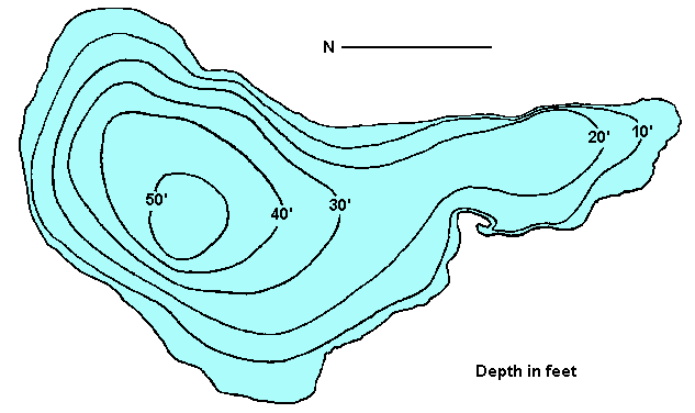
Click
on the lake icon at the right to see full bathymetric map.
Click on the moose on the left for complete BC travel information
Location:
From Quesnel, cross over the
Fraser River and head west on the Nazko Road for 35 km 21mi). The
lake is on the south side of this good gravel road.
Resorts
& Campsites:
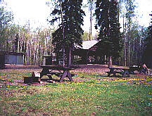
A picnic and recreation site with outhouses is available. Quesnel
is the closest centre for facilities and services.
BC Adventure Network members serving this area:
If you would like to have your business listed, please Click Here.
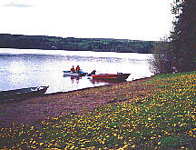
Fishing
Report: The wild stock rainbow trout can reach about
a pound, although they are known for being quite elusive. Be sure to visit Fishbc.com
for angling information!
Viewscape:
The hilly surrounding area is predominantly forested, with a mixture
of aspen, willow, cottonwood and Douglas
fir. Pastureland composes about 10% of the lakeshore area.
Shoreline:
Sandy, gravel soil comprises most of the shoreline with a small
amount of willow in evidence.
Nearby
Lakes
Puntataenkut
Lake: Puntataenkut Lake (also known as Tibbles Lake)
is located about 6.5 km. (4 mi.) west of Puntchesakut Lake. This
279 ha. / 690 acre lake reaches a maximum depth of 14.9 m. / 49
ft. and is home to both Rainbow Trout and Char.
Note:
Always check your current BC Fishing regulations before you start
fishing a new lake.


 Resorts
& Campsites:
A picnic and recreation site with outhouses is available. Quesnel
is the closest centre for facilities and services.
Resorts
& Campsites:
A picnic and recreation site with outhouses is available. Quesnel
is the closest centre for facilities and services.