Easily
one of BC's best kept secrets is Highway #33 that runs north/south
between Kelowna in the Okanagan and the tiny community of Rock
Creek nestled just north of the Canada/US border on the main road
to the Kootenays.
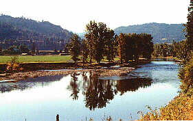
Following
the course of the Kettle River this highway winds it's way through
some of the most scenic landscapes in the province.
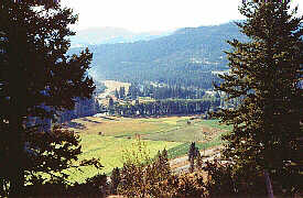
Peaceful
farm lands fill the valley while numerous side roads lead to fishing
and camping adventures on the areas streams
and lakes. Along the route, several small communities offer a
variety of services; Carmi, Beaverdell
and Westbridge.
In
the south, Highway #33 ends at Rock Creek when it meets Highway
#3 between Osoyoos and Grand Forks.
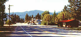
The
community of Rock Creek offers a service station, accommodation
and restaurants.
The
nearby bridge over the Kettle River and oldest operating hotel
in the province are worthwhile attractions to visit.
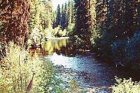
The
area's once prosperous gold rush of the mid 1800s led to the building
of the Dewdney Trail. A beautiful campsite on the river allows
visitors angling opportunities, good swimming and hiking.
Accommodation/Adventure
Providers
If you would like to have your business listed, please Click Here.
City
Information
Location:
Located on Highway 3 between Midway and Osoyoos.
