Lodging & Services Recreation Cities & Towns Lakes Travel Info Points of Interest Provincial Parks Trails
Road
Reports for Northern
British Columbia Northwest & Yellowhead Highway #16
Highway
16 and Connecting Routes:
Hwy
16: (Queen Charlotte Islands):
Hwy
16:
Prince
Rupert to Terrace:
Terrace,
Kitwanga, Smithers, Houston, Burns lake, Vanderhoof to Prince
George:
Prince
George, Slim Creek, McBride, Tete Jaune to the Alberta Border:
Hwy
27: Vanderhoof to Fort St. James:
Hwy
35: Burns Lake to Southbank:
Hwy
37: South: Terrace to Kitimat:
Hwy
37 North:
Kitwanga,
Cranberry JCT, Meziadin JCT, Bob Quinn Lake, Tatogga, Dease Lake
to the Yukon Border:
Hwy
37A: Stewart to Meziadin:
Hwy
51: Telegraph Creek Road:
Hwy
7 Atlin to the Yukon Border:
Hwy
118: Topley Landing Road: Topley to Granisle:
Plan
a Vacation
Lodging
& Services: more
info
Accommodations Adventures Attractions
Events Dining
& Entertainment Shopping
Transportation Conference
Centers Publications
& Media
Recreation: more
info
Attractions ATV
Boating
Camping Canoeing
& Kayaking Dog
Sledding
Fishing Golf Guest
Ranches
Health/Spas Cat
& Heli-Skiing Hiking
Houseboating Mountain
Biking Mountain
Climbing
Multisport Natural
Hot Springs River
Rafting
Scuba
Diving Skiing Snowmobiling
Whale
Watching
Featured
Vacations: View all
vacations
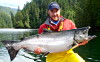
Legacy Lodge at Rivers Inlet : Legacy Lodge provides a true awakening to nature & the ultimate sportfishing experience. Remote yet easily accessible, ours is a world of its own on the waters of Rivers Inlet. This is a premier fish... more
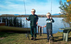
Queen Charlotte Lodge : For those seeking the ultimate sport fishing adventure, the waters of the Queen Charlotte Islands and Naden Harbour are legendary for an abundance of Chinook & Coho – plus Halibut, Lingcod, and grou... more
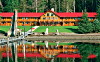
Round Lake Resort : A BC Tourism Approved, Smithers, Telkwa, Bulkley Valley accommodation with lake-shore, nature trails and rustic cozy cottages on Round Lake. more
Regional
Information
Cities
& Towns Lodging, Hotels, Services
& Events . . more
info
Lakes Resorts,
Cabins, Fishing Info, Maps . . more
info
Travel
Info Travel
Journals ,
Tourist
Info Centers, Weather,
Road
Conditions, BC
Ferries Info, Travel
Planner . .
more
info
Points
of Interest . .
more info
Provincial
Parks
. . more
info
Trails Hiking
& canoeing trails . . more
info
Promote
your business on the BC Adventure Network. more
info.
Advertising
Inquiries: advertising@ibcnetwork.com
�©
1995 - 2018 Interactive Broadcasting Corporation
Follow Us On Facebook List of BC Adventure Site Info
Advertise With Us Awards About Us Contact Us
Free Vacation Guides
BC Vacation Guides Coastal Vacations Thompson Okanagan EcoTourism Fishing Vacations Guest Ranch Guide Romantic Getaways Wilderness Vacations Winter Vacations The Rockies Guide
Login